
What Does “Silk Road” Mean?
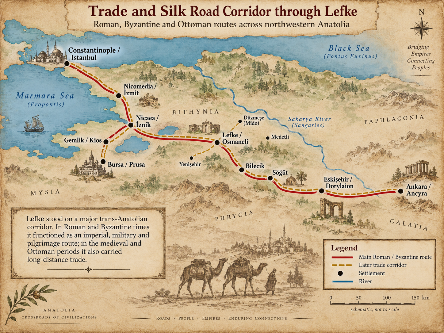
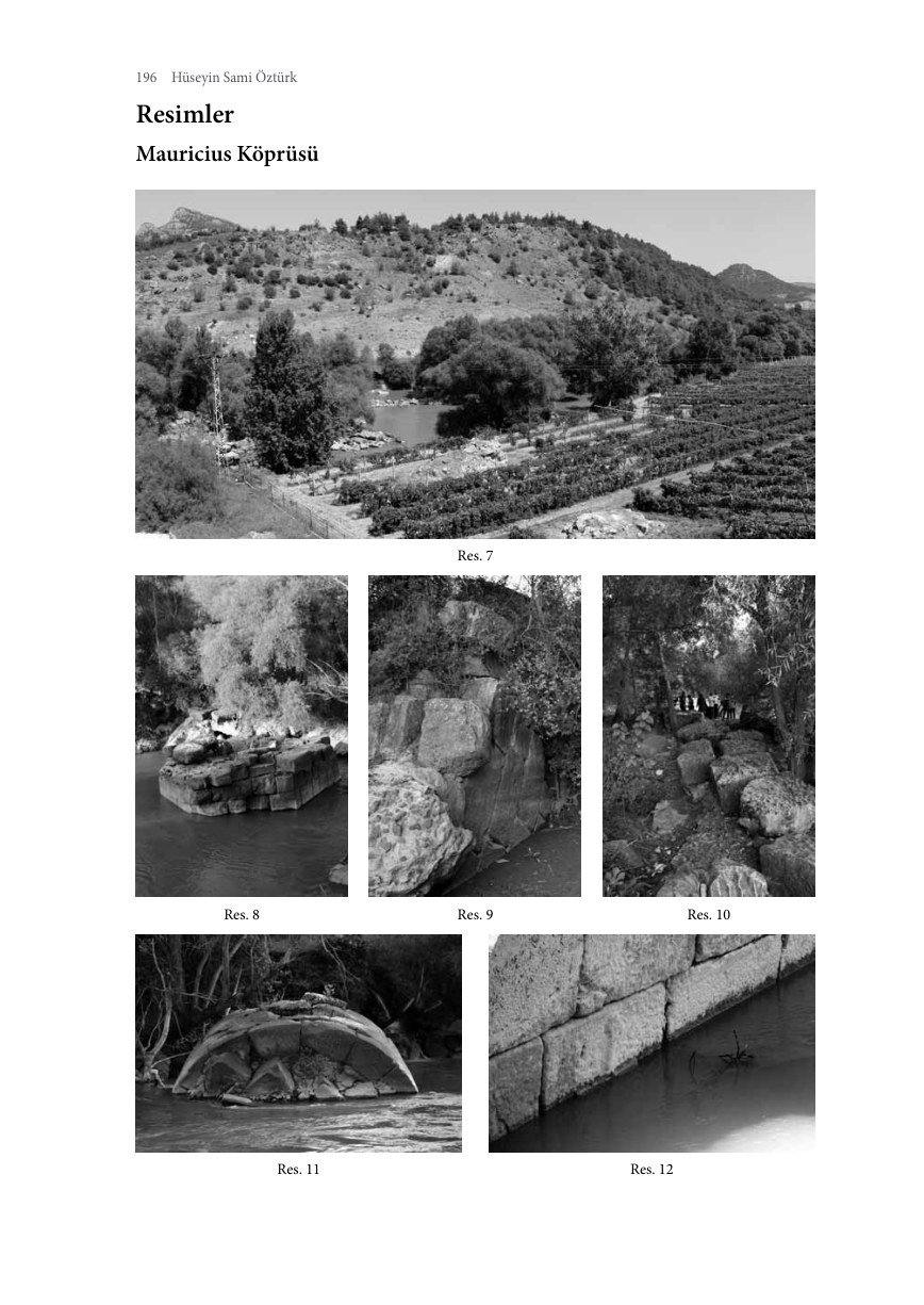
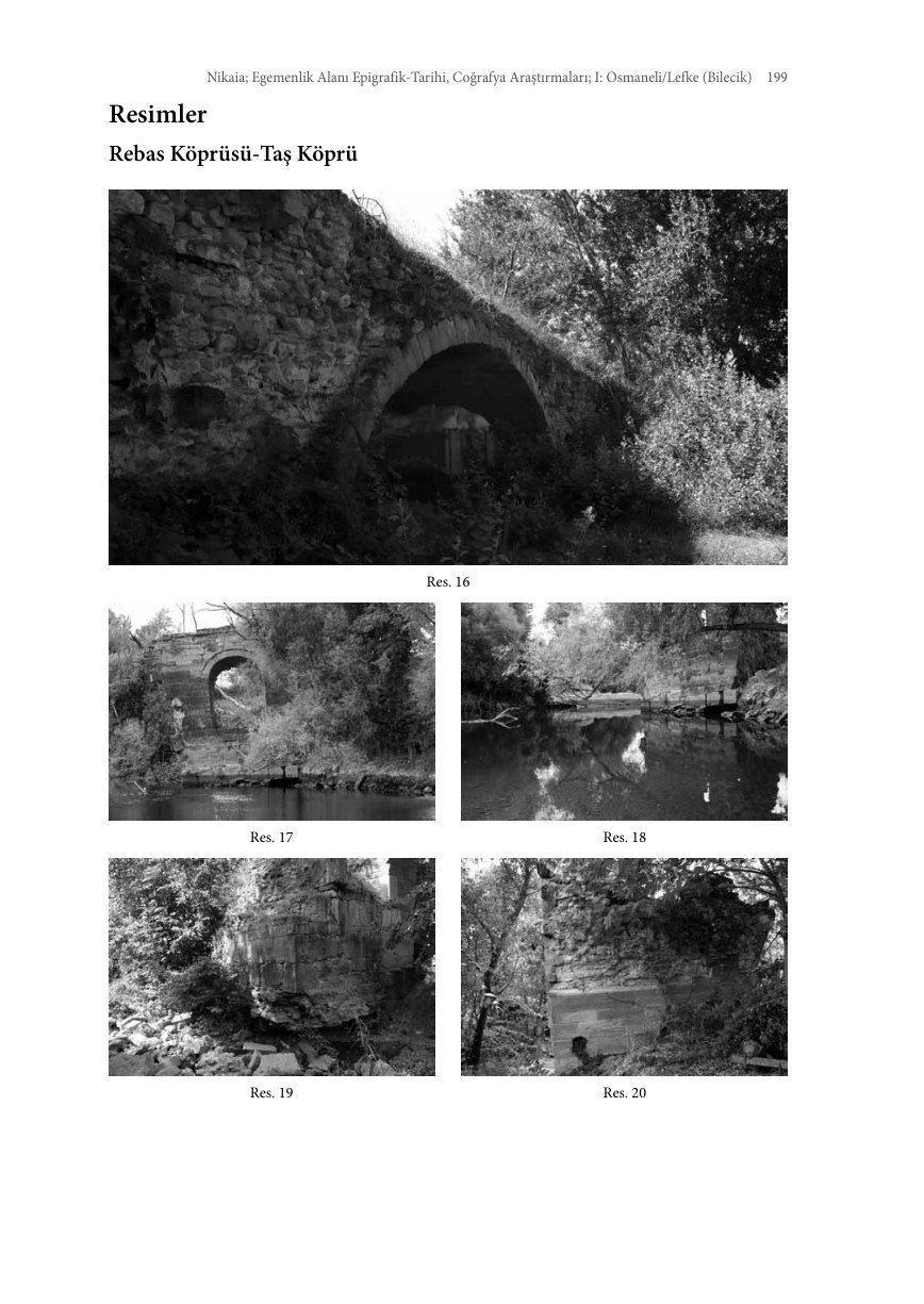
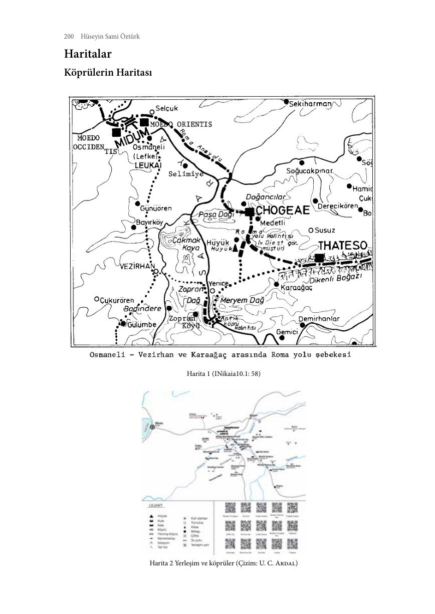
Around Lefke, Roman milestones, bridge remains, a mansio and mutatio provide material evidence for the main road east from Nikaia. In Byzantine times the same corridor continued as a military and pilgrimage route.
“Silk Road” was not the official name of a single ancient road. For Lefke, a more precise description is the Constantinople–Nikaia–Lefke–central Anatolia connection functioning within medieval and Ottoman trade networks as a branch of the wider Silk Road system.
Route
Some source maps, charts and plans retain Turkish labels; the captions are in English. Label key: harita = map; köy = village; merkez = town centre; yol = road; nehir = river; nüfus = population; göç = migration; yıl = year; kadın = female; erkek = male; eski = historical; güncel = present-day; compass K/D/G/B = N/E/S/W.
The Road Economy
Düzmeşe / Mansio Mido
A station associated with accommodation and official road services, with Roman milestones nearby.
Büyükyenice / Mutatio Chogeae
Identified as a station connected with changing horses and transport services.
Ottoman Period
Lefke remained on a main route from Istanbul into Anatolia. Rüstem Pasha’s caravanserai and later the railway illustrate the continuity of this transport function.
Visual Evidence for the Roman / Pilgrimage Road




Ellezler Inn and Ottoman Trade Infrastructure
The Route within the Town
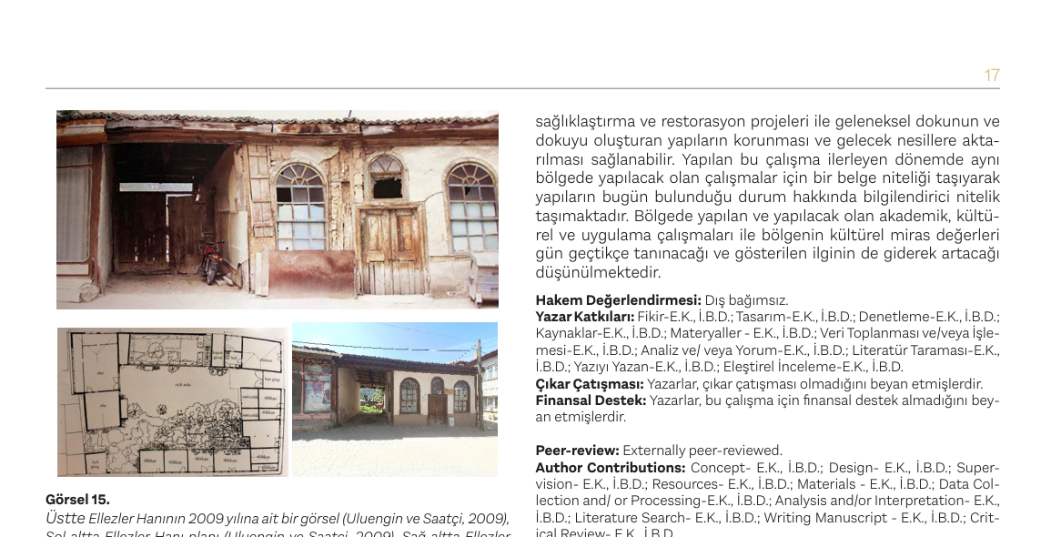
Lefke’s position on east–west trade and pilgrimage routes supported the growth of inns and shops. Ellezler Inn on Sakarya Street is a late Ottoman example of this continuity.
Shops, Stable and Hayloft
The inn’s plan combined shops of different sizes opening onto the street with stable and hayloft areas, accommodating travellers, animals and commercial goods in the same building.
Contribute to the Research
If you have photographs, documents, gravestone records or family accounts relating to Lefke, please share them with us.
✉ Contact Form